


Get ready for more rain and thunderstorms next week. Another outbreak of severe weather is looking promising on Tuesday. Much cooler air and sunshine return later next week.
According to our weather partners at KTAL NBC 6:
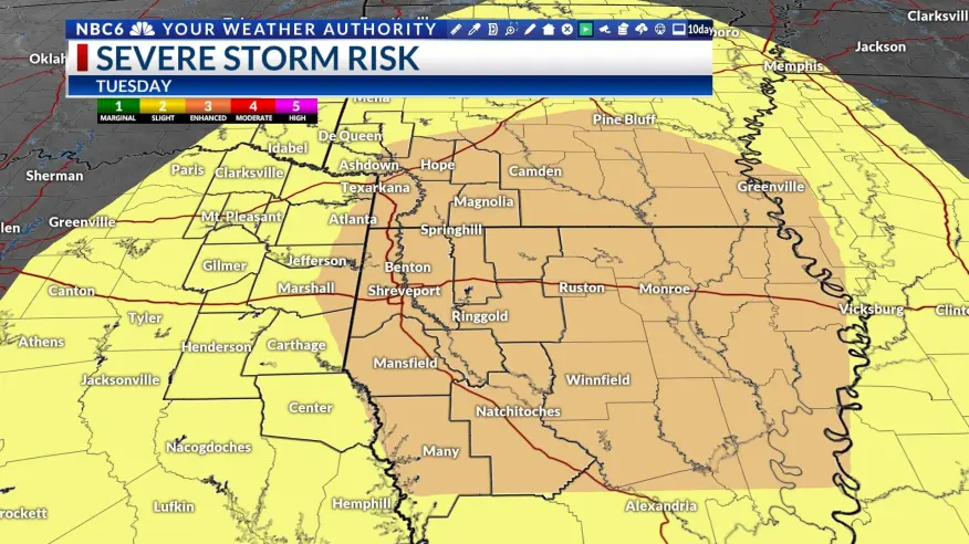
A strong disturbance will move into the middle of the country by the first half of next week. This will push a cold front through our area Tuesday. With temperatures ahead of the front in the 70s and plenty of upper-level support above us, severe weather will be possible. The Storm Prediction Center now indicates that there is enough model agreement to indicate that we could see a decent outbreak of severe weather, especially in the east half of the area. This part of the ArkLaTex will have an enhanced severe weather risk. The rest of the area will have a slight risk. All severe weather threats will be possible including the chance of seeing a few tornadoes. The rest of next week is looking dry as sunshine finally returns for several days.